Category: News
ASTRIIS develops a platform for offshore asset management
Asset management of offshore infrastructures, such as steel platforms that support a power generator to produce electricity from wind, are subjected to many degradation mechanisms. Direct exposition to adverse environmental conditions, including waves, winds, and humidity, do constitutes a serious threat to the conservation and stability of those infrastructures.
It is therefore important to predict the structural behaviour of these systems to prevent any catastrophic event. Prevention of infrastructure degradation is a mandatory action in any offshore industries. In the first place, accessing these infrastructures is difficult in most cases, and, secondly, any maintenance or reparation action at sea tend to be complex and consume an important number of resources.
ASTRIIS, under the leadership of Instituto de Soldadura e Qualidade (ISQ) and in cooperation with Sensorlink (Norway), developed a test system to remotely collect relevant data from these types of offshore assets. Adding to the data collected by floating buoys, the new data obtained with the new ASTRIIS sensors continuously monitors key indicators that allow to assess the condition of the steel in any offshore infrastructure.
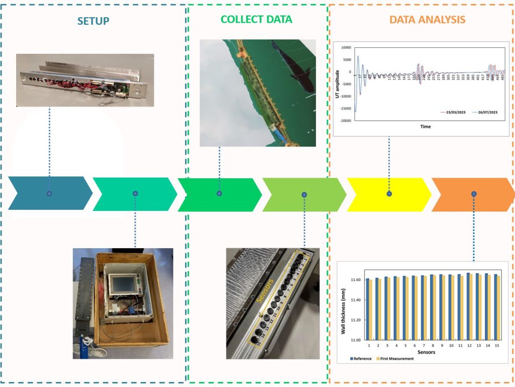
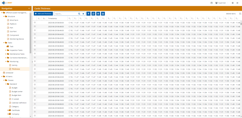
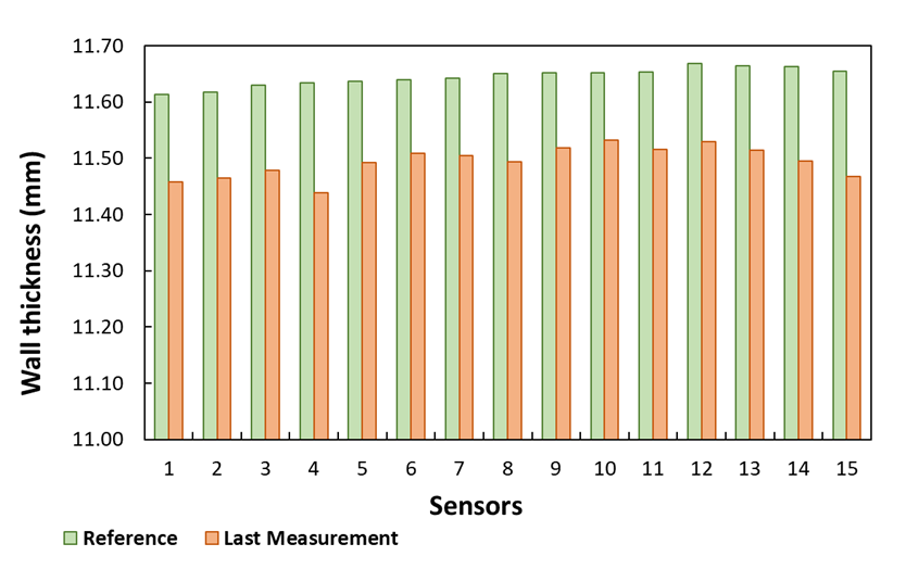
The ASTRIIS team, led by ISQ, installed a series of sensors in an offshore steel platform to measure seawater temperature and steel thickness. The system was remotely accessed by the Asset Management Platform and makes accessible the collected data. The system allows the infrastructure managers to monitor the evolution of the corrosion rate of the steel.
The information generated can thus be used to analyse the evolution of steel degradation mechanisms supporting the asset manager in key decisions concerning the opex and capex of the offshore infrastructure.
Stay tuned to the ASTRIIS website and LinkedIn for further developments on this and other ongoing project activities.
ASTRIIS develops multiparameter surface buoy
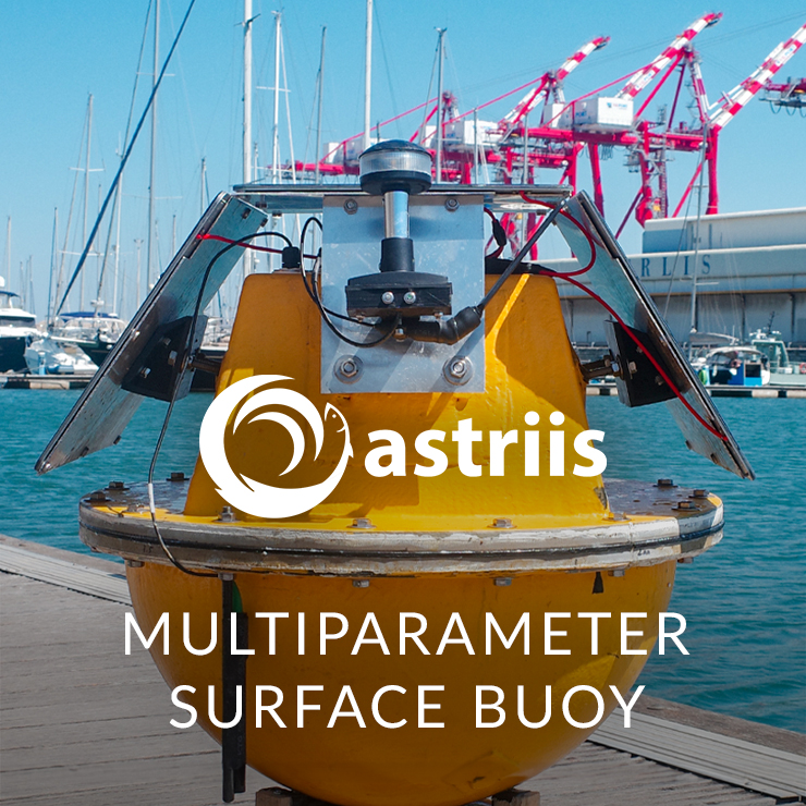
ASTRIIS is developing an innovative ocean monitoring systems based on a small autonomous buoy capable of acquiring data from different types of sensors in a marine environment and export that data to be accessible from land. The project has been working on deploying hydrophones and other ocean sensors to support environmental impact assessments, underwater acoustic measurements and characterisation of noise sources, acoustic modelling (noise source, noise propagation, noise maps) and marine mammals’ observation and acoustics (use of hydrophones and C-PODs).
Under the leadership of WavEC Offshore Renewables, the project has been developing a relatively small data acquisition buoy that results from numerous in-situ environmental studies, which need several campaigns to deploy and retrieve sensors. This requires a big effort regarding the logistics to make sure all the data is acquired and would be significantly simplified if the acquisition equipment could be remotely accessed and automatically powered by other device, such as a buoy.
“Currently, there are no available products with a wide range of sensing and capable of exporting data in real time for these purposes” said Inês Machado, Head of the Marine Environment and Licensing Area of WavEC.”
“Despite there are already some solutions available in the market for ocean monitoring and sensing, very few allow real-time access to data” said Luís Amaral, Project Engineer at WavEC. Moreover, these solutions tend to be heavy and require complex logistics for deployment, leading to higher deployment costs.
The ASTRIIS multi-parametric buoy aims to reduce the number of in situ field surveys and costs associated. Additionally, it brings the possibility of accessing data in real-time, and to remotely evaluate data availability and quality.
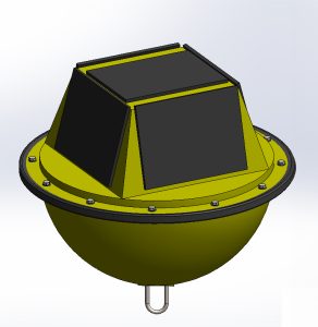
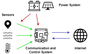
The buoy will be composed of the following subsystems:
- The Communication and Control System – The data acquisition system is expected to reach TRL7 during the life of ASTRIIS. It receives information from sensors and returns, in real time, data to a datalogger which uploads it to an FTP server. This system is also responsible for monitoring the power system status continuously and manage the energy consumption based on that information. Acquisition rates, modes and communication settings are controlled by this unit, which can shut down or restart sensors and communications whenever necessary. These rates and frequencies are user-defined.
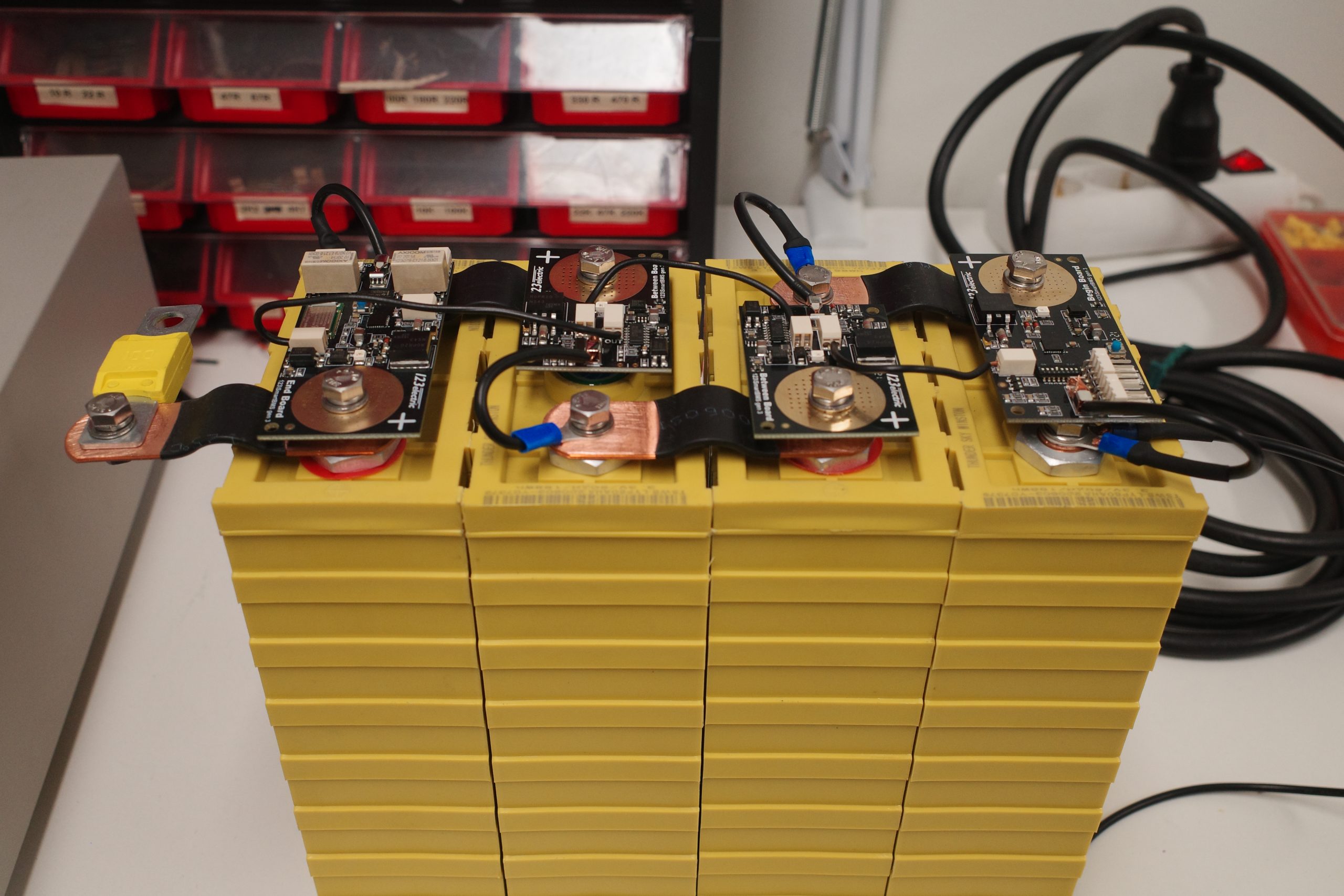
- Power System – Concerning the power system of the buoy, it consists of three photovoltaic panels with a capacity of 17W (18V) and a 60Ah LiFePO4 battery. The panels position and tilt angles take into consideration Portugal’s low inter-annual variability of the solar resource and batteries. It is also designed to work in full mode for more than three days with zero power input.
- Sensors – Acquired data by the sensors will be remotely available. One sensor will measure the temperature of the water and another the salinity. The GPS location of the buoy will also be returned.
Below is the system architecture:
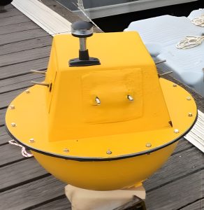
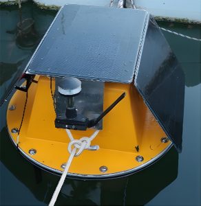
To accommodate the systems described before, a floating structure was developed. The structure of the buoy is constituted by two halves. The bottom halve is round and grants stability to the buoy, and the other, being prismatic, allows the usage of planar photovoltaic panels and the ability to position them in a way that will capture the maximum sunlight.
This solution has been prepared by WavEC since the beginning of the project and it is currently in the testing phase. These tests comprise not only structural tests to find the buoys payload but also the watertightness (since it is crucial that the electronic parts are not in contact with water or moist), communication tests and the assessment of data consistency.
Stay tuned to the ASTRIIS website and LinkedIn for further developments on this and other ongoing project activities.
ASTRIIS develops a data centre to store, process and share ocean information
Despite all the attention the ocean and marine science have received in recent years, a few major issues remain to solve: how to get all the ocean data needed and then how to store, share, and exploit it in sustainable ways?
The ASTRIIS project intends to acquire, value, and make use of ocean in-situ and remote data in several ways. The increase of ocean data and knowledge is expected to leverage several areas, such as research, innovation, tourism, renewable energy, aquaculture, and maritime safety while it is also expected to contribute to respond to climate change, marine pollution, and various other ocean hazards. When used, for example, in data science, artificial intelligence (AI), machine learning, numerical modelling, and geographical information systems (GIS), the potential of ocean data reaches, indeed, unheard levels.
ASTRIIS will acquire ocean data in situ through various activities including, for example, marine animal tags, multi-robot systems, autonomous surface vehicle, among others. The project will also make use of data sources coming from public ocean initiatives, such as Copernicus, EUMETSAT, and NOAA. One of the key issues of ASTRIIS was therefore about how to handle such volume of data.
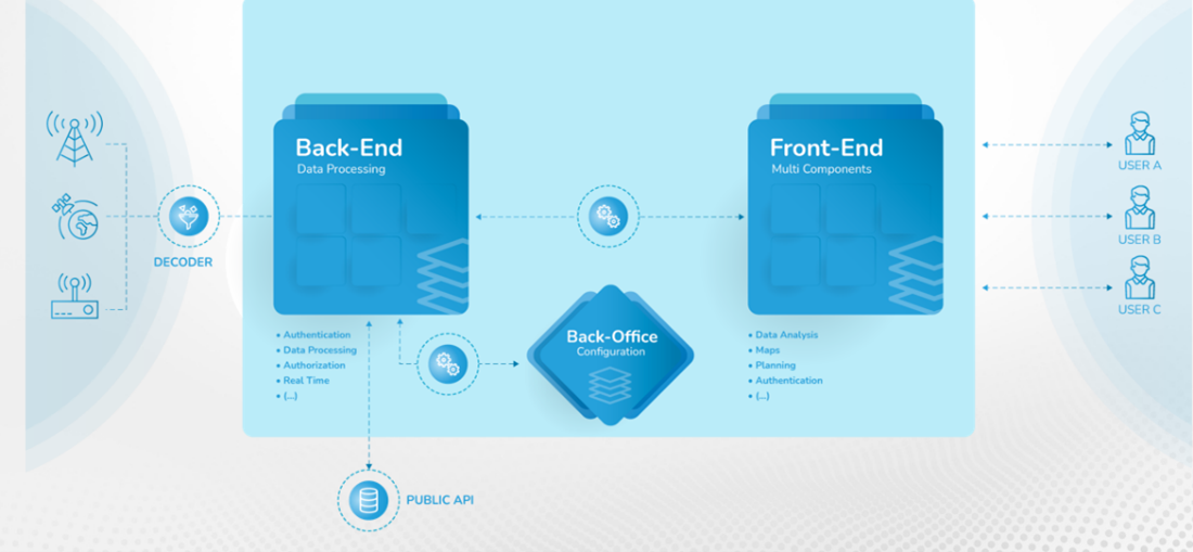
The ASTRIIS solution is based on the development of a data centre that will be more than a conventional data repository. Under the leadership of CEiiA, the project will build a digital platform for the upcoming years which will store considerable amounts of ocean data, making it accessible to supply several users’ demands.
Data centres are commonly defined as electronic devices used for data processing (using servers), data storage (storage equipment), and communication (network equipment) capable of processing, storing, and transmitting digital information. They are known by numerous names depending on the purpose: data farms, data hubs, data warehouses, data halls, AI labs.
The development of the ASTRIIS data centre consists of a four-step methodology, namely descriptive analytics, diagnostic analytics, predictive analytics, and prescription analytics. The platform will allow easy and intuitive access to data in different maturity levels. The platform considers a service-based architecture and, a microservice-based development capable of receiving various types of data from several sources, allowing to create distinct products for different customers/stakeholders.
The platform follows a typical software web development, having a Back-End (data acquisition from many sources), an ETL (Extract, Transform and Load), Intelligence (data science), and a Front-End (web dashboard) development. Besides having access to large amounts of data on a single platform, the users will be able to correlate different data layers from various sources using various AI models.
Would you like to know more about the data layers or interaction options? Drop us an email to astriis-coordination@tekever.com.
ASTRIIS to detect and classify oil spills and other ocean hazards
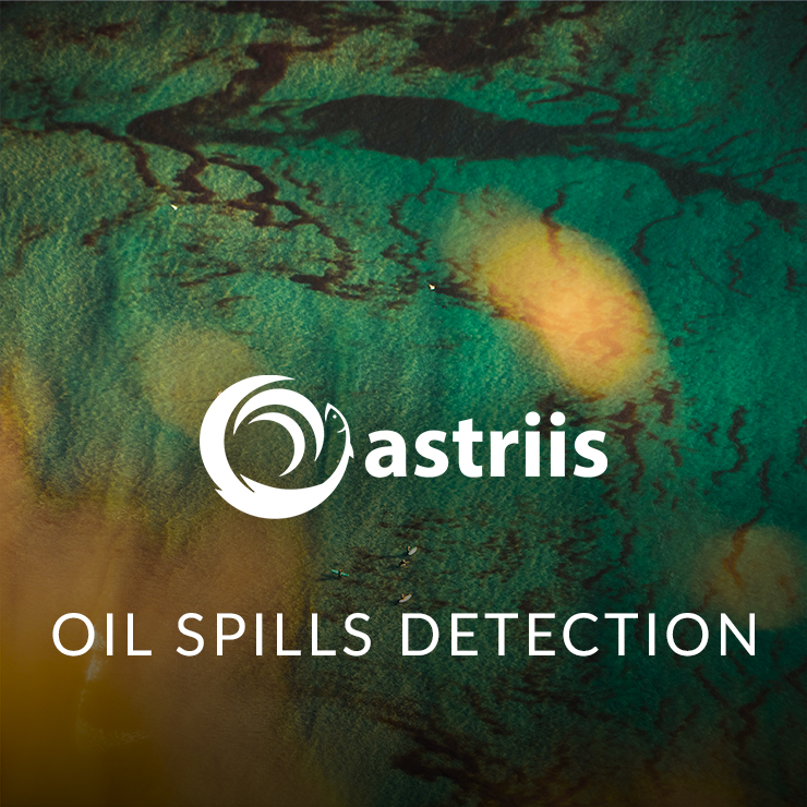
With a large variety of resources coming from the ocean, there is a growing need for services of surveillance and monitoring the surface of seawater. Hazards such as oil spills, toxic algae and plastic patches constitute a looming threat towards the ocean’s health, disturbing its environment and biodiversity, while also impacting blue economy industries like fisheries and aquaculture. Having means to detect, classify, and monitor such hazards, will not only help reduce their damages, but may also help to prevent them and to identify who is responsible.
ASTRIIS is developing a solution consisting of a merge of different sensors and platforms. Under the lead of Tekever, such activity is focused on sensors beyond the standard RGB cameras, namely SAR (synthetic aperture radar) and a hyperspectral camera.
SAR is a type of sensor meant to be operated airborne and serves to obtain aerial imagery either from an aircraft or a satellite. This technology makes use of radio waves, some signal processing, and the movement of the airborne vehicle itself to acquire a detailed relief mapping of the Earth’s surface. The method is fast and can cover large areas quickly.
In a marine context, the texture of the surface of the seawater can reveal the presence of contaminants. For example, since oil has a higher viscosity than water, in an oil spill scenario the wind will not create wavelets on the oil. This way, in SAR, a spill will appear as a smoother area on an otherwise rougher ocean surface.
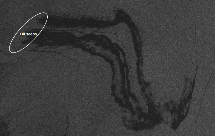
Other hazards, such as harmful algae blooms (HAB), plastics or even animal feces can also cause anomalies in the surface of the ocean. This way, using SAR alone it would not be possible to tell these apart. To make this distinction, ASTRIIS proposes using an auxiliary method: hyperspectral imaging.
Standard RGB cameras, such as digital photography cameras acquire three values of data per pixel: red, green, and blue. However, the real light spectrum is continuous, with the colours existing in-between and as a combination of these. A multispectral or hyperspectral camera subdivides the light spectrum and acquires from tens to hundreds of values per pixel. This way, there is the potential to distinguish between materials even if these appear as the same colour to the human eye. This process nevertheless produces large quantities of data, which is harder to transmit and process if larger areas are covered.
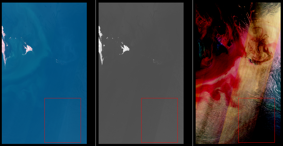
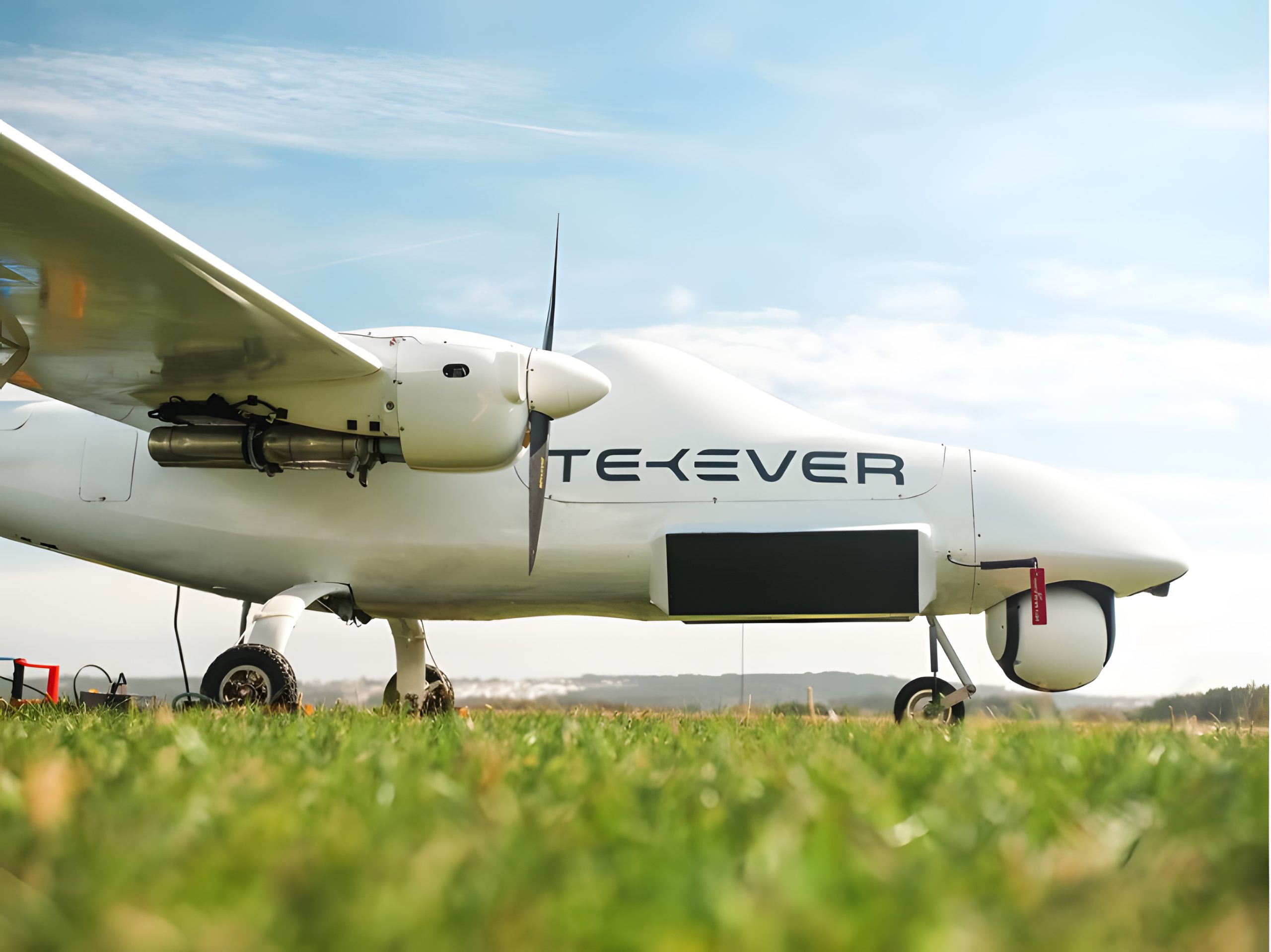
This way, ASTRIIS proposes a combination of techniques, where a larger area is scanned using SAR, and once hazards are detected, using hyperspectral imaging solely on the area of interest, the event is classified. The sensors are to be mounted to an AR5 system; an unmanned air vehicle developed by Tekever with an autonomy of 12 hours.
Stay tuned to the ASTRIIS website and LinkedIn for further developments on this and other ongoing project activities.
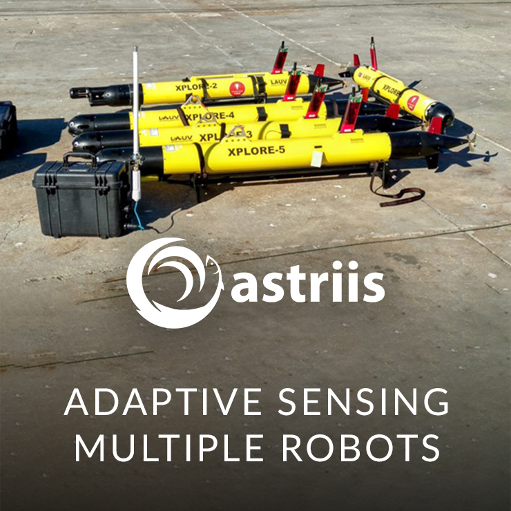
ASTRIIS develops a multi-robot adaptive sensing system for ocean observation
Ocean fronts, an important ocean phenomenon that is hard to spot
Although the ocean may look very static to the naked eye, it is composed by multiple bodies of water that are in permanent movement and play a key role in the functioning of the planet and in its biodiversity, including human life. For example, the cities of Porto (Portugal) and New York (USA) are roughly located at the same latitude. While it rarely snows in Porto (or anywhere in the Portuguese coast for that matter), NYC (and most of US Eastern Seaboard) is famous also for its blizzards. The ocean circulation – namely, the Gulf Stream – ensure that western Europe is much less cold than the opposed margin of the North Atlantic.
The seawater follows fluid dynamics, just like the air does. Water with higher density will move towards places with lower water density. What makes the density vary in the water is both the temperature and its salinity, so these are the variables that ocean scientists need to know in depth to understand how the ocean functions and to forecast how it may change.
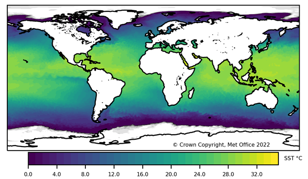
When two bodies of water with different densities meet, a lot of turbulence and other interesting things happen at surface and under the water. One of such things are called ocean fronts. Many scientists have devoted their lives studying them. Although there are satellite products that can sense the ocean’s temperature, such data only show how temperature changes at the surface and with low resolution.
Within the scope of ASTRIIS, FEUP and OceanScan-MST have been developing new technology to automatically acquire ocean data, at the surface and underwater, where ocean fronts form. Such goal is becoming a possibility with multiple smart robots that work collaboratively to produce 3D models of the ocean.
Adaptive sensing using multiple robots
Identifying, accessing, and monitoring ocean fronts while they occur is no easy task. The ocean is a big, often rough, playing field. One way to monitor vast areas of the ocean is to navigate through its waters at a relatively fast speed and to slow down when and where the properties of the water start changing. This allows to obtain more water samples where it matters most, optimising the time onboard during a research expedition. By adapting both the way the sampling station moves and the sampling frequency – this applies to both manned ships and robots – is called adaptive sampling.
A fleet of multiple Light Autonomous Underwater Vehicles (LAUV) robots can work as a network so that their coordinated action allows to monitor larger areas of interest with much more detail. They can start by being spread out in the ocean and, if one robot detects a feature of interest like an ocean front, the others can join and contribute to obtain much more data.
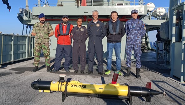
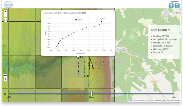
Within the context of ASTRIIS, LAUVs equipped with CTD (conductivity, temperature and depth) sensors have been used to collect data off the coast of Portugal. Such data is sent by the LAUV in near real-time through satellite communications to Ripples, FEUP’s a cloud-based service that receives all the data and stores the actions executed by each of the robots. On land, faraway away from where the feature of interest is occurring, scientists can analyse the data and decide where the robots’ fleet should go and how they should act.
Stay tuned to the ASTRIIS website and LinkedIn for further developments on this and other ongoing project activities.
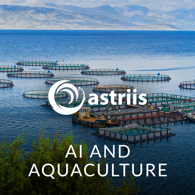
Discover how ASTRIIS is employing Artificial Intelligence to optimise the management of aquaculture
With the rapid increase in world population, the sustainability of resources is a necessity to ensure a viable future. Did you know that more than half of the fish and seafood for human consumption comes from aquaculture?
According to the European Commission, 20% of the fish in Europe comes from aquaculture. The industry is key to ensuring food security for millions of people in developing countries. Sustainable aquaculture can contribute to help solving some of the most pressing issues society faces today. It can ensure food security, alleviate pressure on wild fish stocks, and reduce the climate and environmental footprint of the global food system.
Aquaculture is therefore an opportunity to meet food demand, but it also places pressure on natural resources and causes a range of environmental impacts.

With these challenges in mind, ASTRIIS, under the leadership of CEiiA, is developing an aquaculture system capable of operating autonomously, with the possibility of being adapted to multiple species of fish and operating in an offshore environment. The Offshore Aquaculture System (OAS) controls the entire aquaculture facility, and its main objective is to ensure the growth and well-being of the fish.
On top of this, ASTRIIS, under the leadership of Ocean Infinity, is designing and developing state-of-the-art technology powered by Artificial Intelligence. The Augmented Aquaculture Monitoring Systems (AAMS) helps to enhance the autonomous management and control system of aquaculture farms in the open sea.
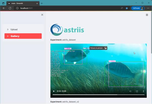
Using the videos captured with the OAS as a baseline, Ocean Infinity applies computer vision algorithms to detect fish and track them. At the same time, we can count the number of fish and monitor their behaviour, namely when they die.
The fish detection algorithm based on neural networks allows the segmentation and tracking of fish in video frames. After detecting the fish, a bounding box is drawn around it on the video feed. In addition, simple heuristics procedures were developed to notify the user and evaluate if the fish is dead. The integration of the sensor’s data from the OAS is superimposed on the video feed providing a detailed view of the state and environment quality of the aquaculture cage.
Aquaculture can be an answer to some of the major problems of today’s society related to resources management. ASTRIIS is aligning cutting-edge technology with the 2030 UN Agenda for Sustainable Development. Its work relates to two of the 17 Sustainable Development Goals, namely SDG 12 (Responsible consumption and production), by fostering aquaculture as a sustainable way to feed society, and SDG 14 (Life below water), by promotingthe sustainable, autonomous, safe, and environmentally friendly exploitation of marine environments and their resources.
Stay tuned to the ASTRIIS website and LinkedIn for further developments on this and other ongoing project activities.
ASTRIIS to assist the studying of large fish and cetaceans with non-invasive underwater device
Although significant improvements in marine data acquisition and processing have been made during the past decades, there is still lack of information and knowledge on in-situ observation infrastructures, as well as on new algorithms built in Earth observation applications retrieved from various platforms. These existing gaps of information about the various marine environments have a negative impact on the sustainable growth of key sectors with high development potential and value creation in the sphere of the blue economy, such as tourism, offshore renewables, and aquaculture along with marine safety.
ASTRIIS is a mobilizing project that intends to mitigate insufficiencies by developing technical and scientific knowledge to conceive and implement a batch of information services and products portfolio emerging from data collected in situ or via remote sensing, combined with forecasting numerical modelling.

The ASTRIIS mission focuses on market needs within the scope of regulation of the maritime space, and on the sustainable exploitation of the oceans and coastal zones. The project also aims to equip society with digital products for training and educational purposes. It is thus intended to contribute to the implementation of the UN 2030 Agenda for Sustainable Development, through the SDG 14 “Life Below Water” and the UN Ocean Decade, by contributing to overcome some of the challenges associated to the protection of the world’s ocean and the boosting of the global blue economy.
A good example of such contributions deals with the ongoing ASTRIIS work on in-situ observations, monitoring and inspection services, which is led by CEiiA. The aim is to develop and manufacture a new generation of in-situ data acquisition systems fostering the sustainability of the ocean in several application areas. The project will thus contribute to further align the blue economy with 5 of the 17 SDGs.
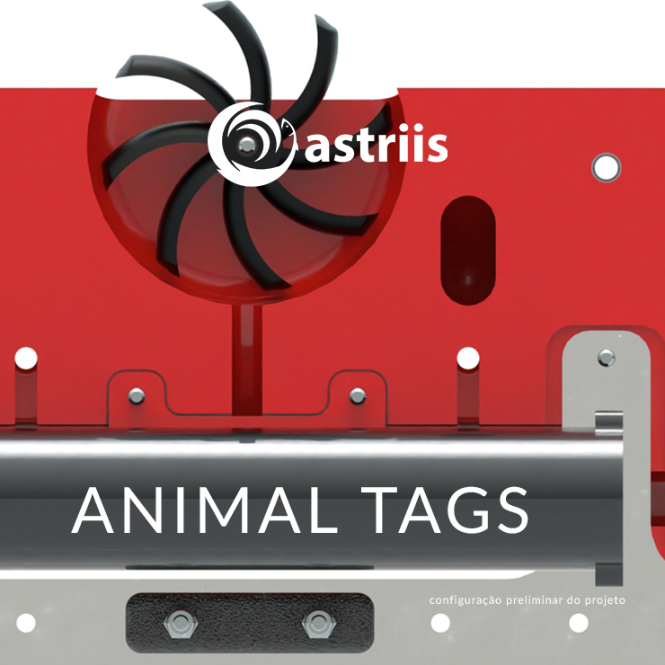
Among these systems are the marine animal tagging devices, which will be equipped with a bunch of sensors capable of recording physiological and biological data as well as live sharing the tag positioning and the corresponding tagged species. These tagging devices, based on a non-invasive and self-recovery concept, will also integrate sensors for blood oxygenation levels and heart-beating measurements to be deployed on fishes and cetaceans.

ASTRIIS is currently working on the mechanical development of the tagging devices, from the materials choice to its manufacturing. During this product development cycle, the ASTRIIS team will be responsible for the following technical areas:
- Requirements and specifications definition along with partners and end-users
- Materials choice, rated up to 2000-meter depth
- Instrumentation definition
- Mechanical design, from conceptual to detailed designs
- Weight and buoyancy calculations
- Hydrostatics and hydrodynamics studies

The ASTRIIS consortium believes that these devices will contribute to increment the knowledge on various marine wildlife endangered species as well as on their habitats, in a harmless and sustainable manner. Stay tuned to the ASTRIIS website and LinkedIn for further developments on this and other ongoing project activities.
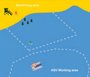
How can ASTRIIS help improve search and rescue of castaway people at sea?
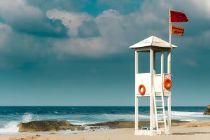
In a typical search and rescue mission a distress call is made, and a lifeboat is sent to meet the people in distress. The Portuguese Institute for Lifesaving (ISN) has 31 lifeguard stations along the country’s coastline and rescue equipment in about 80 fire brigades. According to this source, in 2020, 985 resources were activated at sea and 613 lives were saved. The question therefore is how to improve the response capacity.
© Camille Brodard | unsplash.com
The development of an ASTRIIS search and rescue system has been going on since the beginning of the project. CEiiA and the +ATLANTIC CoLAB joined forces to conduct exhaustive research on buoys and rescue techniques in use, and came to the conclusion that it would be more efficient to develop a system of their own. As a fruit of this collaboration within ASTRIIS and with this goal in mind, a demonstration scenario of the technology and its requirements was defined.
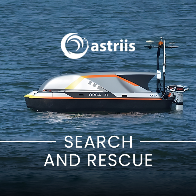
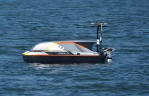
The CEiiA’s autonomous surface vehicle (ASV) type ORCA was chosen as the basis for this activity. The ORCA can reach speeds of 9 km/h and 24h autonomy and operates in coastal regions. It is designed to adapt to the needs of each application, including for now a multibeam sonar, GPS, AIS identification, navigation lights, a 360º camera and a Wi-Fi antenna to be remotely controlled. To meet the ASTRIIS requirements, it will have to accommodate a self-propelled buoy and drop it in a specific location.
© CEiiA
In practical terms, a part of the search and rescue mission will have to be ensured by the ASTRIIS platform, which receives the call for help, calculates the estimated operation and rescue times and returns a result (“GO” or “NO GO”) depending on whether there is a reduction of the rescue time compared to the usual procedure. If the decision is to go ahead, the rescue buoy is launched and will reach the castaway at sea shortly after the call for help has been launched on the platform. By being remotely controlled and monitoring its battery levels, we will be able to conclude in real time if this part of the mission was a success or not.
©+ATLANTIC
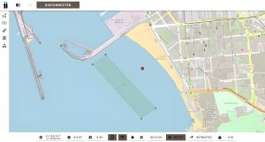
As for the ASV and buoy control, CEiiA is developing a remote control software (ground station). This system will represent an important component for the ASTRIIS project, since it will use prediction models, being able to estimate the displacement of the castaway according to the currents and consequently its position, and calculate the waypoints of the buoy.
The demonstration of the system is planned to take place in Matosinhos in June 2023. Stay tuned to the ASTRIIS website and LinkedIn for further developments on this and other ongoing project activities.
© CEiiA
ASTRIIS consortium presents results in person for the first time since Covid19
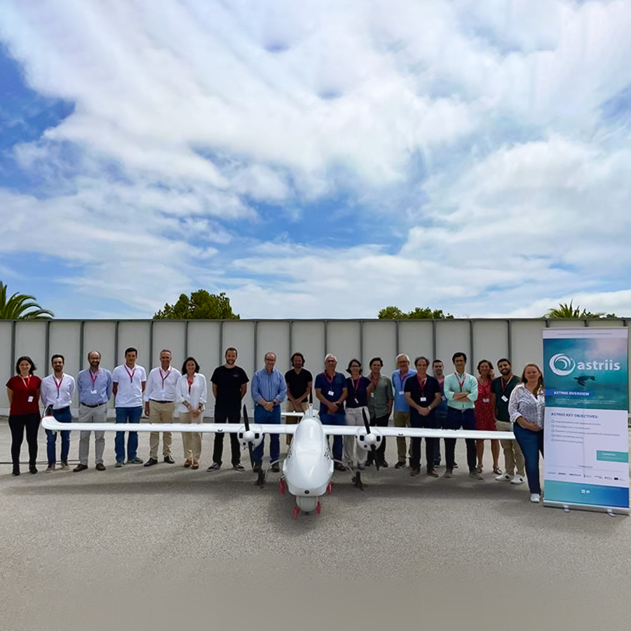
The ASTRIIS consortium met in person, in near full force, for the first time since the Covid19 outbreak. All partners sent representatives to the TEKEVER facilities near Caldas da Rainha, Portugal. Twenty people were at site, while ten others joined the event online.
During a full-day meeting, partners presented the latest results achieved, discussed various relevant scientific and technological matters, and made decisions concerning the following steps until the end of the project on 30 June 2023.
Among the various noteworthy achievements, we could highlight the progress achieved on:
- Data Platform: CEIIA, ATL, IST-MARETEC and TEKEVER described how the ASTRIIS platform is being developed, interoperability aspects and graphic user interface
- Animal Tags: CEiiA and University of Minho showed the latest developments on the marine mammals tagging equipment that allows to acquire ocean data without harming wildlife
- Multiparametric Surface Buoys: WavEC and +ATLANTIC presented an easy-to-deploy data buoy that can collect ocean data with little effort
- Seismic Data: IST-CERENA described how ASTRIIS will infer physical ocean data from seismic surveys that the oil and gas industry discards
- Aquaculture Management: CEiiA and Ocean Infinity showed a computer vision system to track and estimate the number of fish to automatically calculate the precise amount of food required for each offshore aquaculture tank
- Search & Rescue: CEiiA and +ATLANTIC introduced a buoy/AUV prototype to locate people lost at sea and send a request for rescue
- Oil Spill Monitoring: IST-MARETEC showed how ASTRIIS modelling technologies can predict oil spill propagation and support manned and unmanned operations at sea. TEKEVER presented results of a study performed with a Synthetic Aperture Radar (SAR) and how this technology could be used for detection of oil spills.
- Environmental Monitoring: SPINWORKS presented a hyperspectral sensor coupled with a thermal camera, allowing monitoring of numerous environmental factors like for instance fluorescence and algae, detection of river pollution and others.
- Long-Range Communication: TEKEVER presented the improvements under developments to extend the communication link between ocean sensors operating at long distances
- Ocean Forecasts: Hidromod, IST-MARETEC and University of Algarve showed the latest developments of the project concerning numerical modelling of ocean hydrodynamics and temperature in Portuguese Economic Zone, allowing support of coast guards in search and rescue missions, monitoring of water quality and ocean forecasts.
- Multi-Robot Adaptive Sensing: OceanScan-MST and FEUP presented new automated coordination strategies for data collection at sea using teams of autonomous robots, both for coastal bottom mapping and oceanic water masses studies.
Stay tuned to the ASTRIIS website and follow us on LinkedIn for more detailed insights on each of these ongoing activities.
ASTRIIS marketplace for ocean data products and services begins to take shape
Under the designation “Atlantic Sustainability Through Remote and In-situ Integrated Solutions”, ASTRIIS is a Portuguese R&D project, funded by Portugal2020 Programme, whose main objective is the development of information services to support sustainable development of the Blue Economy.
The project will help to fill the existing knowledge gaps by collecting, harmonising, and making available data on the observation of the marine environment with in-situ means and new applications based on Earth observation via remote sensing, either by space platforms or by aerial means.
The project consortium is led by Tekever Space and joins key Portuguese companies and R&D centres from the sector, namely +ATLANTIC, CEiiA, ISR, MARETEC and CERENA from IST, LSTS from FEUP, Universidade do Algarve, Universidade do Minho, ISQ, Tekever AS, WavEC, Oceanscan, Abyssal, Hidromod and Spin.Works. ASTRIIS work is organised to provide a set of products and services, emerging from data acquisition through in situ observation and remote sensing, combined with numerical modelling and forecasting and integrated into a market platform.
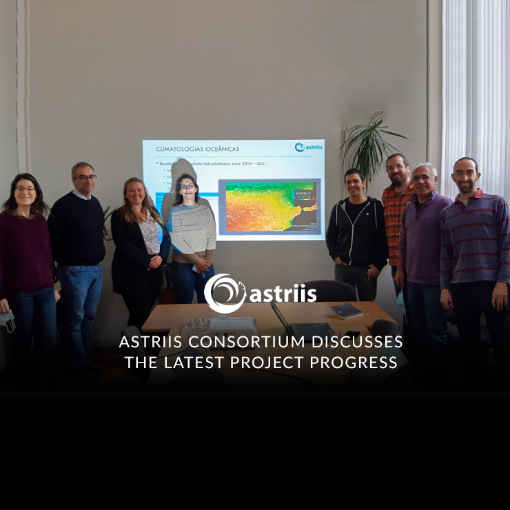
On 7 April 2022, +ATLANTIC, MARETEC and Tekever gathered at Instituto Superior Tecnico, Lisbon for a presential meeting to discuss project achievements and integration of modelling solutions into the market platform. During this meeting, the project team defined the data standards for communication of model outputs into the platform, which will act as a data hub integrating some of the project services. Potentially, the platform can provide access to products and services in areas as distinct as:
- Search & Rescue
- In-Situ Data
- Autonomous Surface Vehicles (ASV)
- Images on Request
- Lagrangean Models
- Harmful Algae Blooming Tracking on Aquaculture
- Modelling
- Propagation
- In-Situ Data
- Images on Request
- Historical Climate Data
- Remote Satellite Imagery
- In-Situ Data
- Modelling
- Oil Spills Tracking
- Remote Satellite Imagery & Data
- Modelling
- In-Situ Data
- Lagrangean Models
On 28 April 2022, all ASTRIIS partners gathered online to discuss the progress in the development of the integrated market platform and the main achievements of the project.
More news from ASTRIIS soon. Stay tuned!